

Mohammed VI-A and Mohammed VI-B, placed in orbit in 2017 and 2018, have long been associated with defence. Their use has since widened, and this shift is what I want to examine here: a capability designed first for sovereignty has become a tool for agriculture, water management and, potentially, diplomacy.
Two satellites, one ambition for autonomy
Mohammed VI-A was launched on 8 November 2017 from Kourou, French Guiana, aboard an Arianespace Vega rocket. Its twin, Mohammed VI-B, joined it on the night of 20 to 21 November 2018 from the same site. Both were built by a Franco-European consortium, with Thales Alenia Space as prime contractor for the system and Airbus as co-prime. They are operated by Moroccan engineers and technicians from a control and image-reception station near Rabat.
These are high-resolution optical satellites. According to the specifications released at the time, they can distinguish objects of about 70 centimetres on the ground. For a non-specialist, that means a building, a field or a vehicle can be identified, but not a licence plate. Flying in low Earth orbit, the two craft complement each other. Specialised press reported, around the second launch, more than 500 images a day from any point on the globe. That figure should be handled with caution, as it describes a theoretical capacity rather than a volume published by the operator.
The initial stakes were strategic. For decades, Morocco relied on images purchased from foreign suppliers, with the constraints that implies in terms of delay, cost and confidentiality. Owning its satellites lets the country decide what to observe, when, and with what degree of secrecy.
A dual civil and military vocation
Moroccan authorities have always presented these satellites as multipurpose tools. The official mission, restated before the first launch, covers mapping and land registry, land-use planning, monitoring of agricultural activity, prevention and management of natural disasters, tracking of environmental change and desertification, and surveillance of borders and coastline.
This duality is a technical reality as much as a political one. An image at 70-centimetre resolution can assess the condition of a crop just as it can observe a sensitive site. According to Moroccan media, Mohammed VI-A is oriented more towards defence and Mohammed VI-B towards civil applications. To my knowledge, this split has not been the subject of detailed official communication, and I present it as such.
Agriculture and water, the first fields of application
The civil uses are where the picture is clearest. In its 2025 statement to the United Nations Committee on the Peaceful Uses of Outer Space (COPUOS), Morocco described space as a lever for sustainable development, climate resilience and resource management. It outlined an approach led by the Royal Centre for Remote Sensing (CRTS) in support of national institutions.
On water and food security, the same statement says a national drought-monitoring system based on satellite imagery has existed since 2015, before the satellites were launched. For groundwater management, it mentions the use of very high-resolution images, notably from Mohammed VI-A and B.
In practical terms, remote sensing makes it possible to:
- map land cover and follow the progress of crops through the season;
- estimate cereal yields before harvest;
- detect water withdrawals and irrigated areas;
- monitor the spread of desertification and the condition of forests.
For a country where agriculture remains an economic and social pillar, and which years of drought have tested severely, such data is clearly valuable. At the time of the second launch, officials and researchers already stressed their usefulness for steering agricultural campaigns and improving sector statistics. One question remains that I cannot settle for lack of public data: to what extent do these images actually reach farmers, cooperatives and private operators, and in what form? A powerful satellite creates value only if the processing and distribution chain keeps pace.
Why Africa comes into the picture
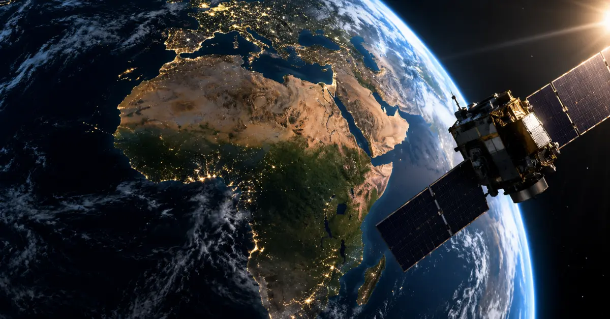
A satellite in low orbit knows no borders. The same sensors that observe the Souss or the Gharb can, depending on tasking, cover the Sahel, West Africa or other regions. That is where the subject changes scale.
Morocco has made South-South cooperation, and food security in Africa in particular, a declared axis of its foreign policy. Morocco’s ambassador to the UN, Omar Hilale, has described food security as a strategic priority of King Mohammed VI for the continent, noting that food insecurity fuels conflict, migration and political instability. In that context, Earth observation data can feed early warnings on drought, crop monitoring or the management of transboundary water resources.
I must be precise, however, about what is established and what is not. That Moroccan satellites are technically able to image African territories is a fact. Whether a structured framework exists for sharing this data with African states, with public volumes, beneficiaries and access conditions, is a point I could not verify in recent official sources. It will be one of the elements to document in order to gauge the real reach of this dynamic.
A Moroccan space landscape in transition
The programme does not stop at these two satellites. University microsatellites, UM5-EOSat and UM5-Ribat, appear in specialised databases with a 2024 date, oriented towards environmental monitoring, education, maritime applications and the Internet of Things. They point to a training effort and a widening ecosystem, even if their capabilities cannot be compared with those of the two main satellites.
The press has also reported that Morocco is preparing a new generation of observation capability, with an OptSat-3000-type satellite designed by the Israeli company ImageSat International, at a resolution of around 40 centimetres. According to these reports, it would replace or complement Mohammed VI-A and B. A reservation is in order: this rests on media sources and, to my knowledge, Moroccan authorities have not publicly detailed the timetable or terms of the contract. If confirmed, it would illustrate a diversification of partners, after a first generation of Franco-European origin, and a notable gain in precision.
The stakes and open questions
Three issues seem to me to frame what comes next.
The first is data sovereignty. Owning satellites reduces dependency, but full independence also requires launchers, ground stations, processing capacity and skills, areas where Morocco still relies on foreign partners.
The second concerns value creation. Images have economic value only if turned into usable services: vegetation indices, yield forecasts, risk maps. The growth of a private geospatial analytics sector, still modest, will be decisive.
The third is geopolitical. Observing neighbouring territories, even for civil purposes, is never neutral in a region where mistrust is real. Clarity on uses, governance and data sharing will be a factor of trust, or of suspicion, depending on how it is handled.
Conclusion
Morocco’s satellites have changed status. A tool of sovereignty at launch, they now serve to monitor drought, water and crops, and open the possibility of a regional role in Earth observation data. The real measure of their success will be played out less in space than on the ground: in the ability to convert images into decisions, for Moroccan farmers and, perhaps tomorrow, for their African neighbours.
FAQ
How many Earth observation satellites does Morocco have?
Two main satellites, Mohammed VI-A (2017) and Mohammed VI-B (2018). University microsatellites were recorded in 2024, with far more limited capabilities.
What is the resolution of these satellites?
About 70 centimetres on the ground, according to specifications released at the time of the launches.
What are they used for on the civil side?
Mapping, land-use planning, agricultural monitoring, drought surveillance, water management and disaster prevention.
Is the data shared with other African countries?
I found no detailed, public official framework on this. The subject remains to be documented.