The debate surrounding the 20% of the wall in the Moroccan Sahara often sparks questions due to the gap between political rhetoric and the reality on the ground. To truly grasp the stakes of this strip located east of the defense system, one must look past slogans and observe the region’s security and economic mapping. This territory, frequently described as a “buffer zone,” is an integral part of Moroccan sovereignty, even though its current utilization differs radically from that of the western provinces.
- The Defense System and Military Reality
- The Radiant Prosperity of the Southern Provinces West of the Wall
- Why the 20% to the East is Excluded from GDP Calculations
- The Fragility of Liberated Zone Claims
- Future Potential for National Growth
- Strategic Integration and Long-Term Vision
- FAQ on the 20% of the Sahara East of the Wall
Historically, the construction of the defense wall (the Berm) in the 1980s aimed to secure urban centers and economic resources against armed incursions. Today, this high-tech technological device has transformed this strip of land into a space under constant aerial surveillance. Contrary to claims presenting this area as “liberated,” the reality is a security glacis where no permanent administrative or civil structures are established.
The Defense System and Military Reality
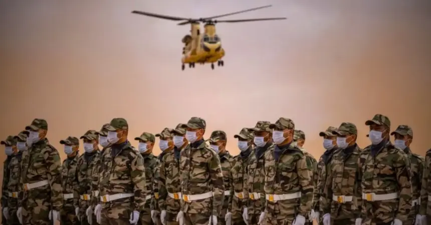
The area located east of the wall represents approximately 20% of the total territory. For Morocco, this strip is primarily a strategic bulwark. Surveillance here is total: latest-generation radars, reconnaissance drones, and rapid intervention units ensure near-perfect sealability. The idea that populations could settle there permanently to found a political entity is a geographical chimera. The few water points or nomadic camps do not constitute a state infrastructure.
Maintaining this zone under a special status responds to ceasefire agreements supervised by MINURSO, but Morocco exercises absolute security oversight. Any attempt at incursion or construction by the Polisario is immediately detected and neutralized, often through diplomatic means or, if necessary, precision strikes. This security stability is what allows the cities to the West to develop without fear of destabilization.
The Radiant Prosperity of the Southern Provinces West of the Wall
When comparing the two sides of the wall, the contrast is striking. To the West, cities like Laayoune, Dakhla, and Boujdour have become true economic hubs. The Moroccan government has injected billions of dirhams through the Southern Provinces Development Model launched in 2015. One finds international airports, modern fishing ports, and cutting-edge universities there.
The economic dynamism of these regions now exceeds the national average in sectors such as maritime fishing and seaside tourism. Dakhla, for instance, attracts investors from around the world for its wind power projects and its future Atlantic deep-water port. These concrete achievements validate the Moroccan strategy: transforming the desert into a pole of sustainable growth. The regional GDP is in constant progression, supported by an emerging middle class and road infrastructures linking Morocco to the rest of Africa.
Why the 20% to the East is Excluded from GDP Calculations
A question often arises: why is the zone east of the wall not included in national wealth statistics? The answer is purely pragmatic. GDP (Gross Domestic Product) measures the value of goods and services produced. However, east of the wall, there is no structured industrial, commercial, or agricultural activity. The priority is exclusively security-oriented.
Without paved roads, a stable electrical grid, or urban centers, this zone does not generate measurable financial flows. Morocco refuses to invest heavily there for the time being to respect diplomatic balances and concentrate efforts on already populated areas. It is a rational management of resources: developing where the people live. The exclusion of these 20% from economic calculation is not an admission of weakness, but a statistical reality linked to the absence of a productive fabric in a sector left in its wild state.
The Fragility of Liberated Zone Claims
The Polisario’s discourse relies on the term “liberated zones.” However, a careful examination shows that this terminology is purely symbolic. For a zone to be truly administered, it must have a healthcare system, schools, a currency, and an autonomous economy. Yet, the Polisario’s structures are entirely based in Tindouf, on Algerian territory.
Structural Limits of the Presence to the East
-
Absence of financial autonomy: Polisario activities depend entirely on Algerian budgets and logistics.
-
Demographic desert: The zone is virtually uninhabited, making any form of democratic or administrative life impossible.
-
Satellite surveillance: Morocco possesses satellites (Mohammed VI-A and B) that document every movement, proving the absence of permanent cities or barracks.
-
Humanitarian dependency: The populations in the camps survive only through international aid, with no productive link to the land east of the wall.
Future Potential for National Growth
Morocco does not consider these 20% of the wall in the Moroccan Sahara as lost land, but as a strategic reserve. The natural potential of this zone is immense. Meteorological records indicate sunshine rates and wind corridors among the most efficient in the world for renewable energies. Eventually, this region could host giant solar parks and wind farms to produce green hydrogen.
Furthermore, the geographical position of this strip makes it a natural corridor to Sub-Saharan Africa. The Nigeria-Morocco gas pipeline project could benefit from the securing of these spaces. By progressively integrating these lands into the economic circuit, Morocco could boost its GDP by several points by 2050. The goal is to transform this security glacis into a lever for green growth and continental connection.
Strategic Integration and Long-Term Vision
The royal vision for the Sahara does not stop at the current borders of urban development. The idea is to create an economic continuum from Tangier to the Mauritanian border. In this scheme, the 20% located east of the wall play a “reserve zone” role. Morocco favors a policy of small steps: first total securing, then international recognition of sovereignty, and finally heavy investment.
This approach contrasts with the adverse political agitation. Morocco builds facts on the ground: schools, hospitals, and ports. Meanwhile, the eastern zone remains under guard, protected from terrorist threats and cross-border trafficking by the Royal Armed Forces (FAR). It is this strategic patience that ensures the credibility of the Moroccan dossier on the international stage, particularly with major powers that recognize the primacy of the autonomy plan.
FAQ on the 20% of the Sahara East of the Wall
Does the Polisario really control part of the territory? No, the Polisario controls no fixed structures or cities east of the wall. Their movements are sporadic and nomadic, under constant surveillance by Moroccan drones. The area is technically a buffer zone secured by Morocco.
Why are there no cities east of the wall? The absence of basic infrastructure (water, electricity, roads) and the military priority make urbanization impossible for now. Morocco concentrates its investments in the West to maximize the socio-economic impact on local populations.
What is the economic future of this zone? The future lies in renewable energies and commercial transit to Africa. Once the definitive political solution is settled under Moroccan sovereignty, these lands will become priority investment zones for green hydrogen.
Is the wall a border? No, the wall is a military defense system and not a political border. Morocco’s border extends well beyond it, to the limit with Mauritania and Algeria, in accordance with the Kingdom’s historical maps.